Vortx-AI has launched emem — a decentralized protocol for verifiable geospatial data, designed to serve as the foundation for creating "Agentic GIS" and providing AI agents with authentic data about the physical world.


What Happened
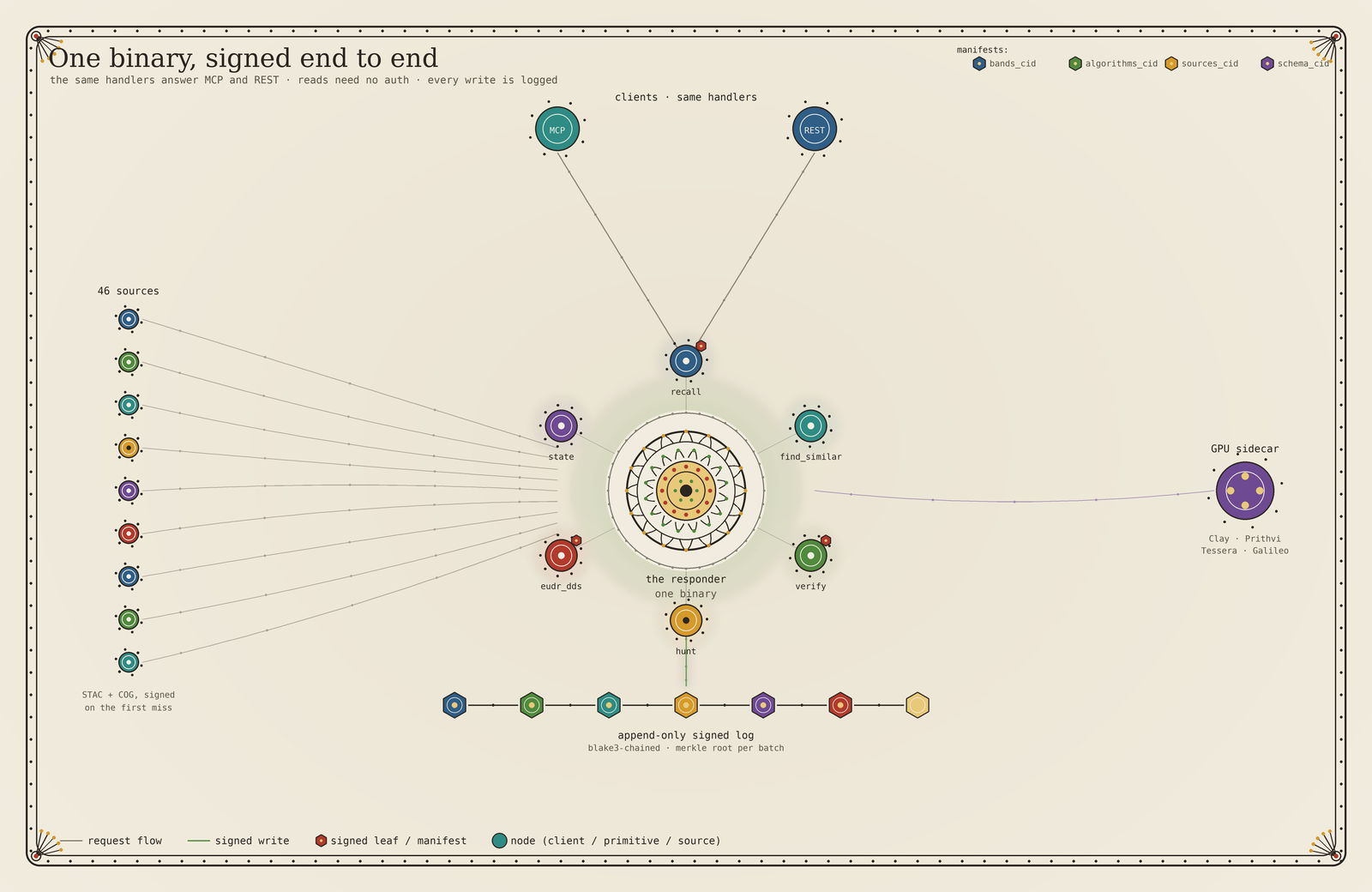
The emem protocol provides AI agents with access to signed (Ed25519) data about the physical world, including satellite imagery and environmental indicators such as precipitation levels or the NDVI index. The system uses a cell64 spatial addressing method, where each cell is approximately 9.55 meters in size, ensuring high precision when anchoring information to geographic coordinates.
Context
To operate in the real world, AI agents require a reliable source of "ground truth." Current solutions often rely on centralized servers, which creates risks of data tampering or model hallucinations when interpreting geospatial information. emem addresses this problem by turning the physical world into a verifiable API.
Why It Matters for the Industry
For the AI industry, this signifies the emergence of a standardized, cryptographically verified data layer. This enables the automation of compliance processes (e.g., adhering to EUDR regulations) and minimizes agent hallucinations when working with physical objects, creating a foundation for "verifiable physical intelligence."
Why It Matters for Users
Developers of agentic systems gain a ready-to-use tool for integrating real-world data into the reasoning loop via MCP (Model Context Protocol) or REST API. This allows for rapid prototyping of specialized agents for environmental monitoring, agriculture, or logistics with guaranteed authenticity of input data.
What Is Not Yet Known / Limitations
Enterprise architects point to the need for further assessment regarding the complexity of integrating a decentralized model into closed corporate environments and verifying the overall reliability of the system.
Sources
Author
Look at AI, Editorial Team